
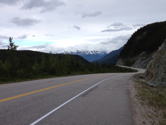
A day with a real sense of accomplishment. For some reason, getting up and over the Rocky Mountains felt like an important milestone. The Robson and Yellowhead passes were quite gradual and manageable. Showers came and went throughout the day but that just added to the mix of experiences.
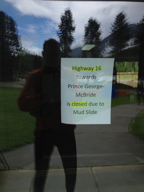
When leaving Tete Jaune, I see that road flaggers have closed the Yellowhead highway heading back towards McBride. It turns out that shortly after my hellish ride yesterday, there was massive landslide, as in eight feet of mud and car-sized boulders flowing across the highway. A risk that never occurred to me in the howling wind.
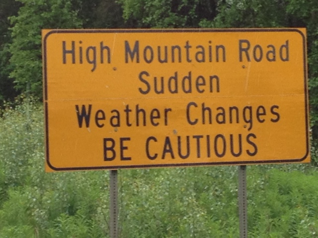
There was no false advertising associated with this sign as it poured shortly after I took the picture.
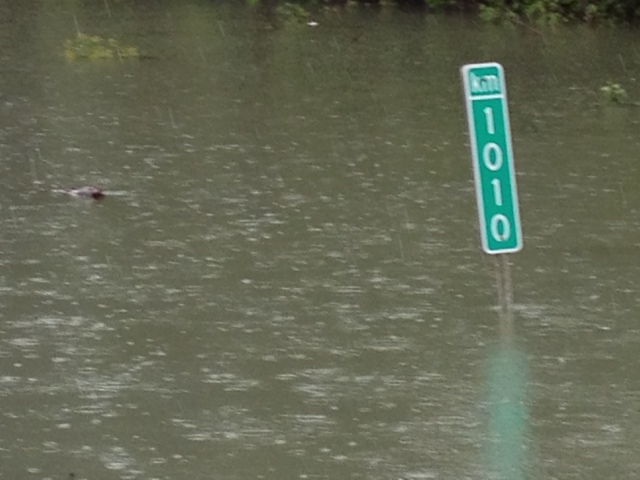
Since leaving the west coast at Prince Rupert, every five kilometers has had a signpost. Here is the last one that I see. It is not meant to be in a river but every creek and river around has overflowed their banks.
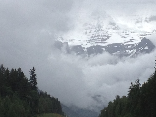
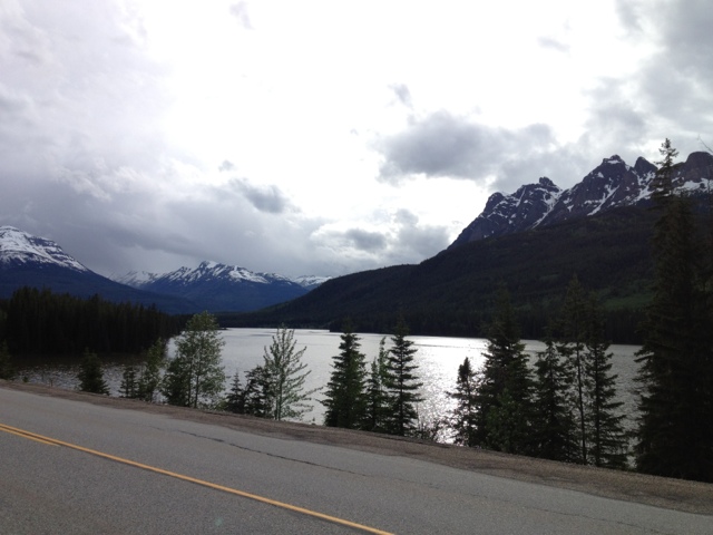
The views approaching Robson Pass make one feel like an ant in the landscape.
Return later to this posting for a video clip of the ride through the pass.
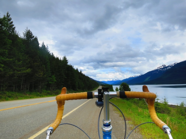
Shortly after Tete Jaune, Route 5 intersects with the Yellowhead Highway and suddenly traffic is thick. More vehicles pass me today than passed me in the thousand kilometers from Prince Rupert. Route five brings travelers up from Kamloops and Vancouver.
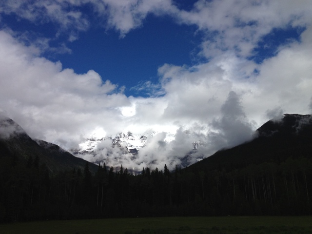
The views through the Rockies are quintessentially Canadian.
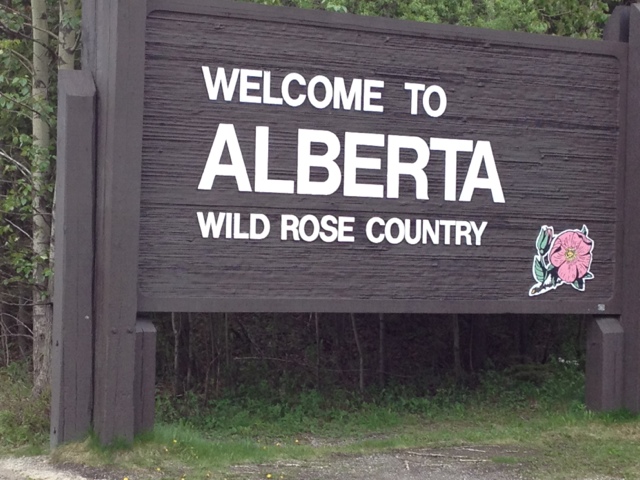
Soon I am entering Alberta.
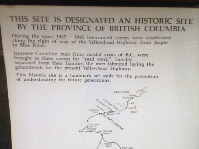
But before that a reminder of who built this highway.
And a final early evening look back from where I came.
And a look ahead to the twenty kilometer downhill ride to Jasper. The road shoulders in Alberta are about a meter wider than in British Columbia but there is no rumble strip to alert drivers if they wander past the white line. Not sure which I prefer.
Jasper has a nice understatement about itself. Being located inside a national park, there are no billboards just a few humble national park signs pointing towards the town. And having reached this milestone and with the need for a laundry stop too, I find an inexpensive room, find a Chinese restaurant for massive order of Ma Po Tofu then sleep heavily.
Stats – for Sunday 17 June 2012
Start: Tete Jaune, BC
Finish: Jasper, AB
Distance: 110 km
Average Speed: 19.1 km/hr
Time on Bike: 5:40
Distance to Date: 1,974 km

Can you email me some more info please, I need more details please zekejordan1@yahoo.com
Hi David
I wonder how many people are living vicariously through you? Your updates are a highlight of my day and am always reassured when they arrive so that I know you have not met a bear up close and personal! Travel well – this truly is a remarkable undertaking.
Tony (still in Nairobi!) and Ann
I thrilled to know this is being read in Nairobi. An inspiration as I just read this sitting out a shower heading out of Jasper National Park. Keep poking me with comments from time to time and forward the blog link on to anyone who Might be interested.
DAVID