Unknown's avatar

About David Hawley

Educator, cyclist, human being

Midnight in Montreal

From Hawkesbury I take the bridge over the Ottawa River and finally make it into Quebec.

20120804-195918.jpg

As wonderful as it was to cycle on the south shore, the feeling and experience is even better on the north side. Why? There are cyclists everywhere and the extensive “La Route Verte” system of cycling paths is well labeled and well maintained.

20120804-200036.jpg

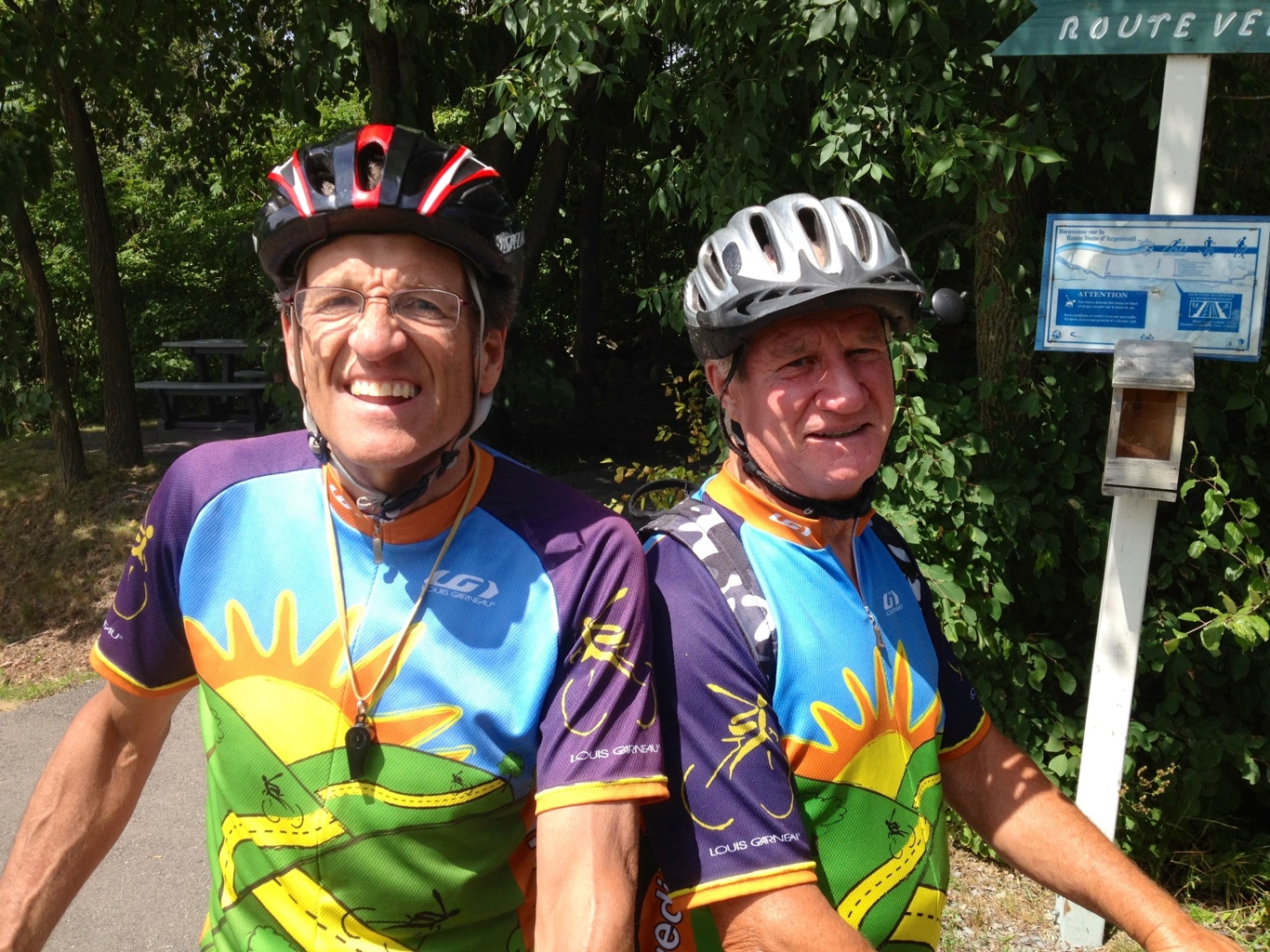
Very early in the day, I meet up with two serious cyclists who give me all sorts of advice about the route to Montreal and they insist that I zipper up my cycling jersey all the way as they were recently stung by bees that got trapped in their open jerseys.

20120804-202734.jpg

I follow La Route Verte 1 all day with the aim of linking up with the pathway along Lachine Canal, which leads all the way to the old port of Montreal.

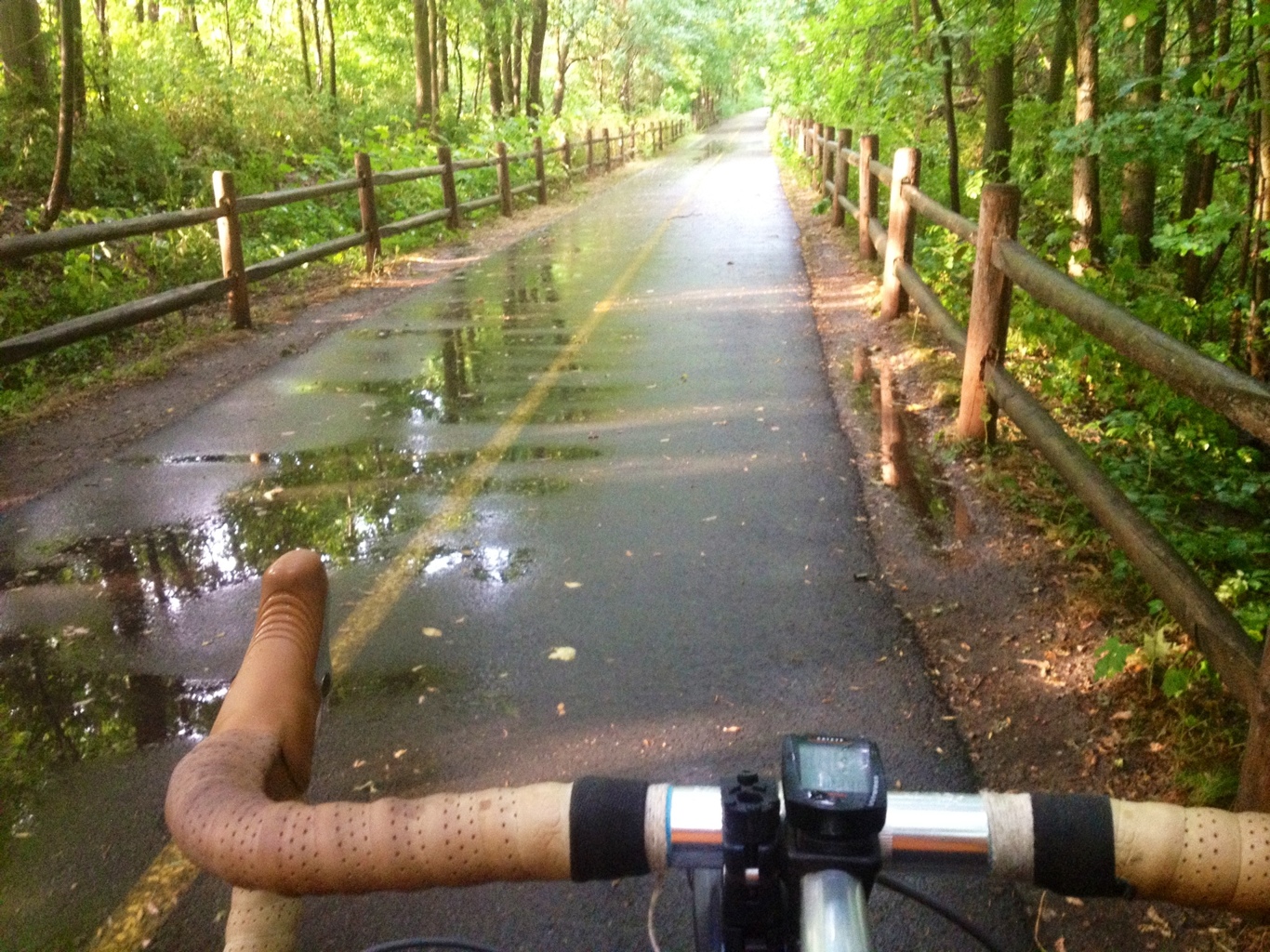
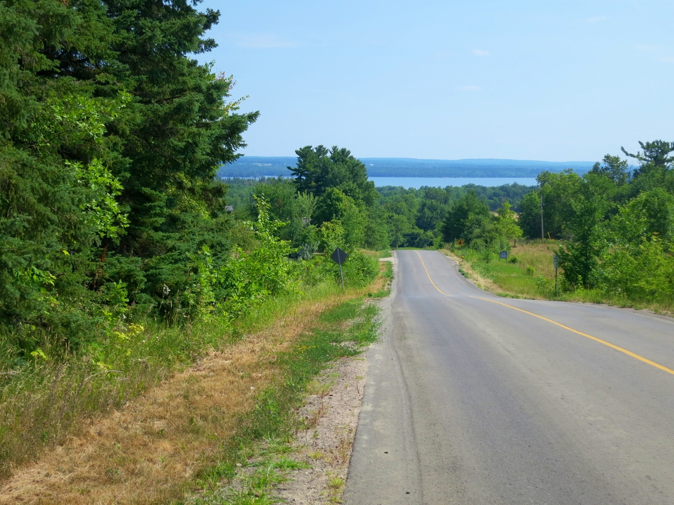
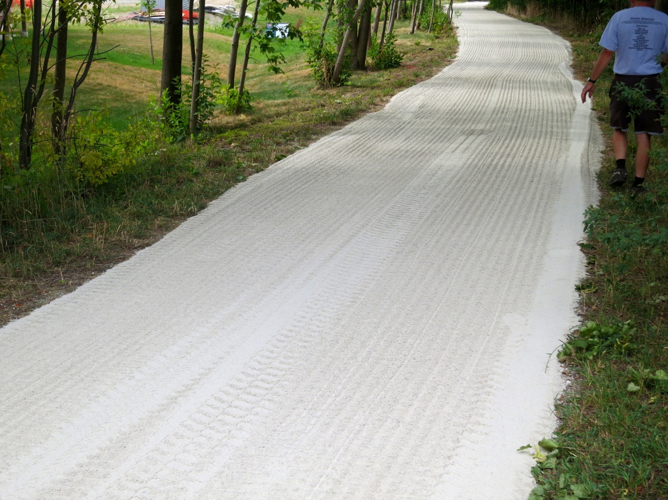
Some of the route is a dedicated bike path through forests.

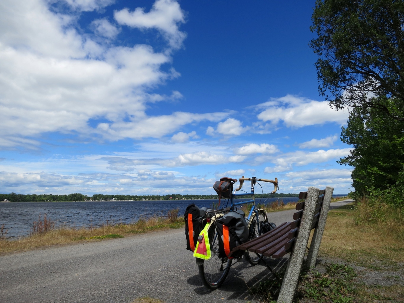
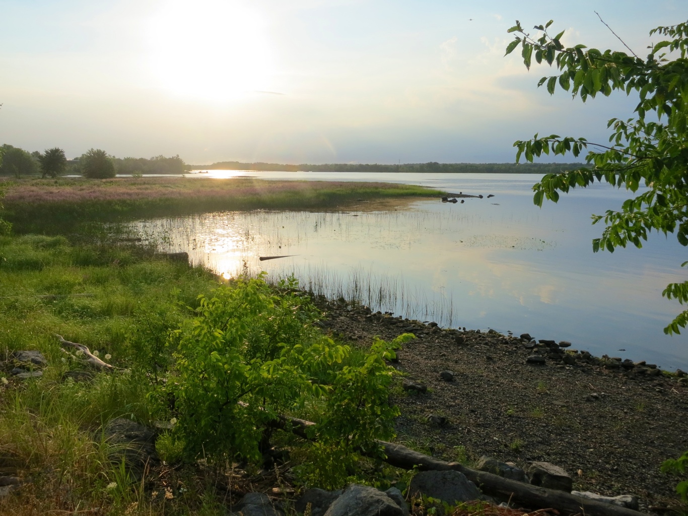
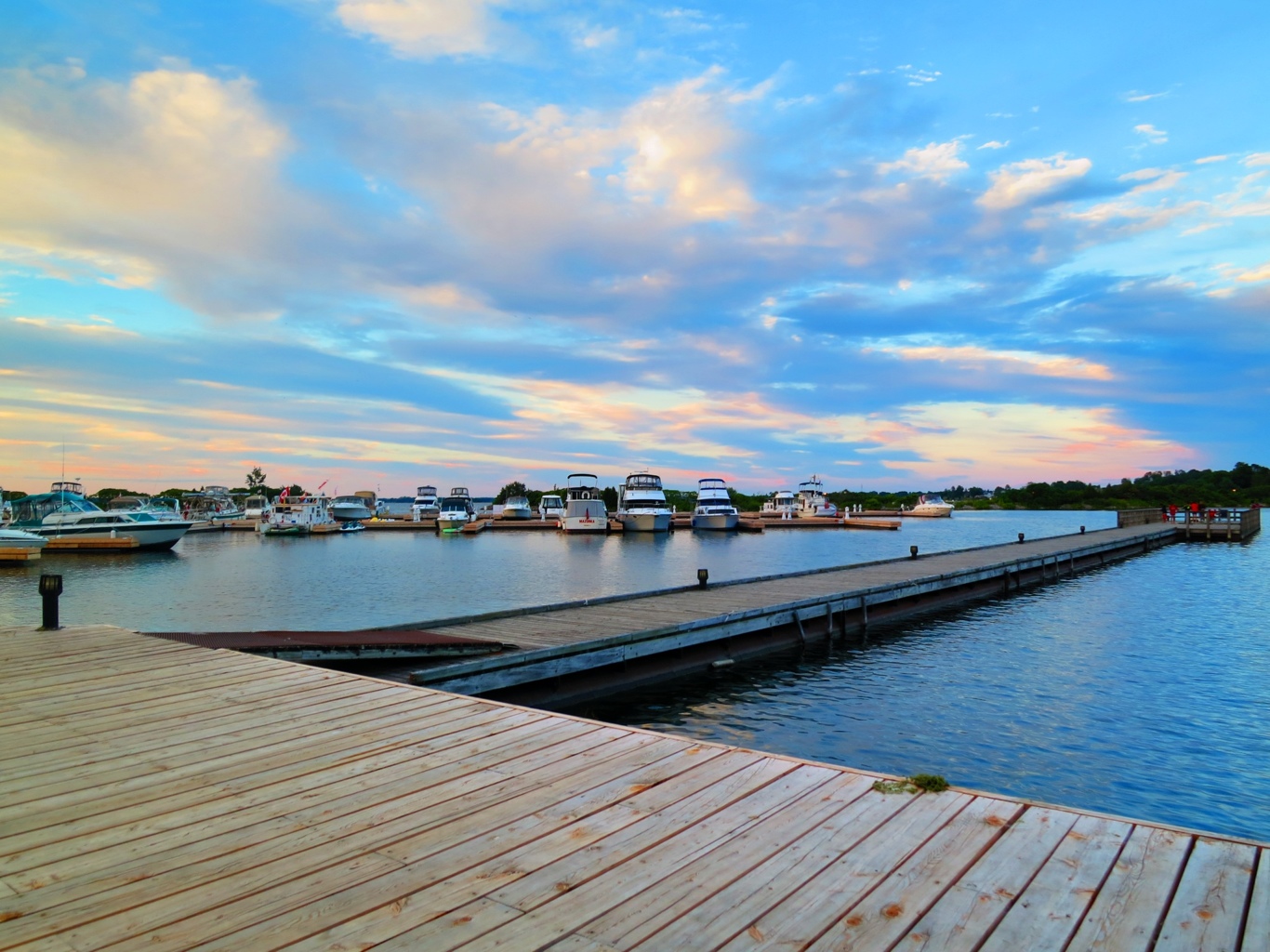
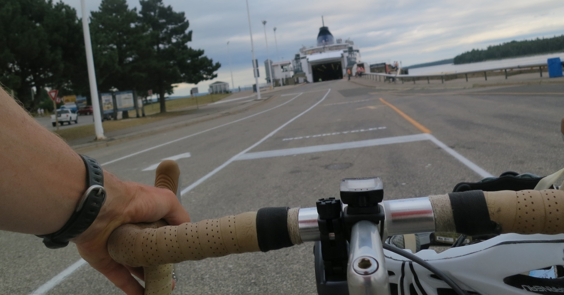
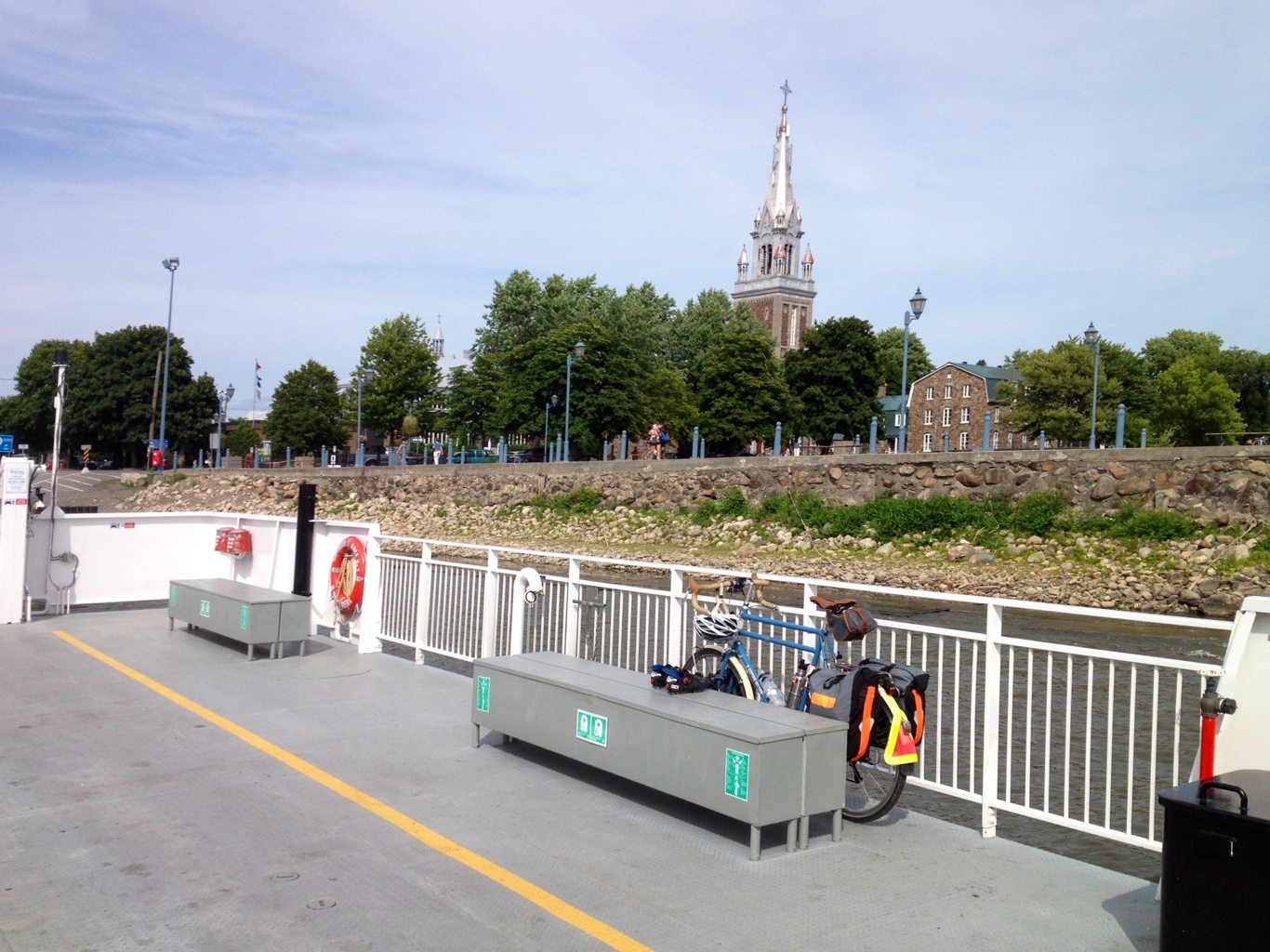
I follow the route of a bicycle blogger I have found helpful throughout the day as the Route Verte system is full of options. It includes taking a ferry across the river at the town of Oka. From the ferry you can see the silver church steeples, something that has dotted the landscape all across Quebec so far.

20120804-211108.jpg

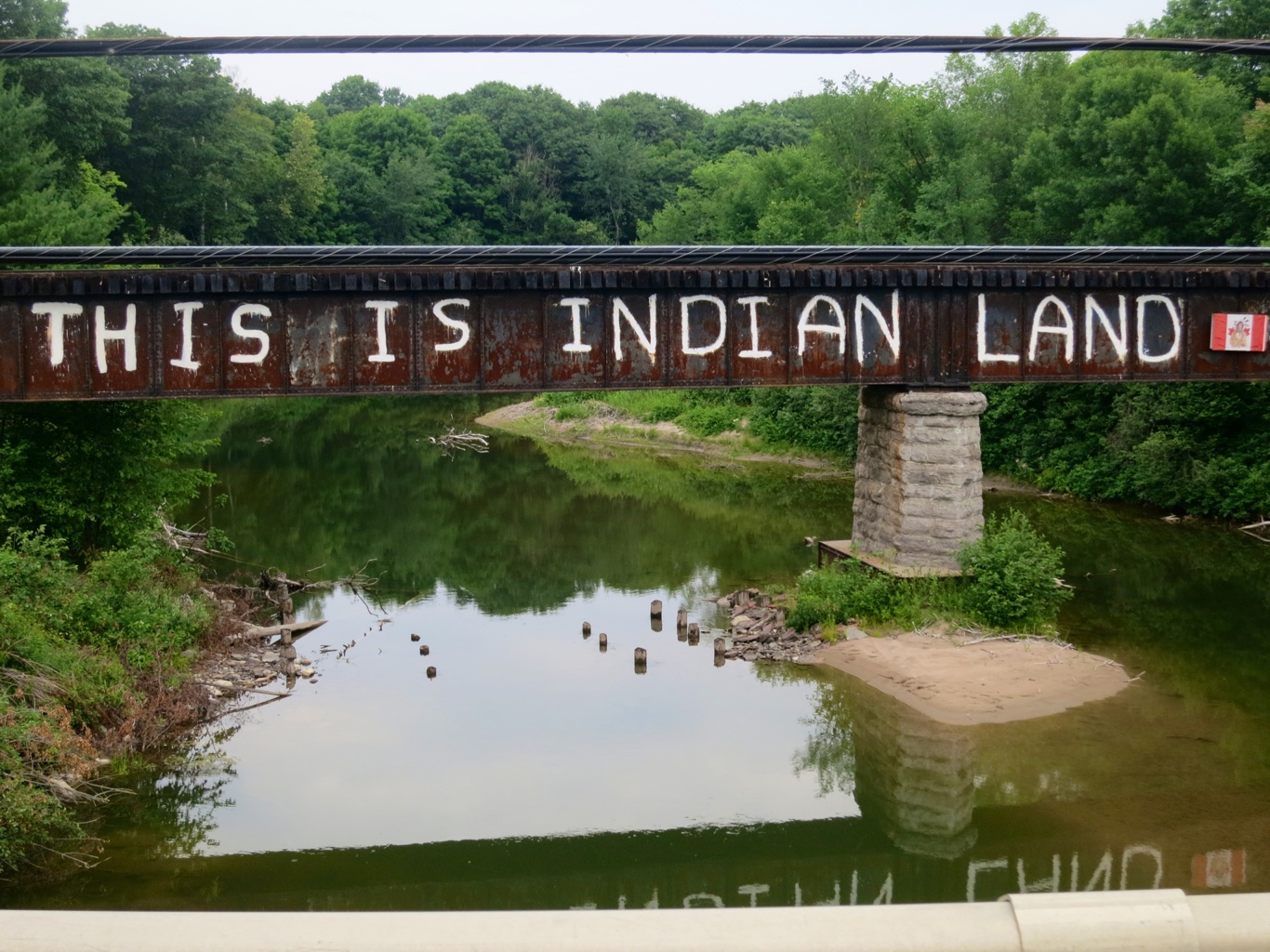
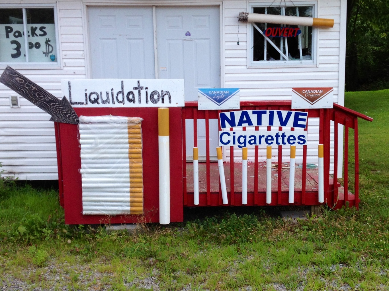
I go through a first nations – Mohawk – community along the way and in a ten kilometer stretch there were dozens of little shacks selling cigarettes. A lot of people still smoke in Quebec, more so than in any other province as far as I can tell. I guess they get them tax free in these shacks.

20120804-212553.jpg

I get closer and closer to Montreal and continue to pass back and forth on each side of the river. In Quebec, always with a dedicated bike lane.

20120804-224213.jpg

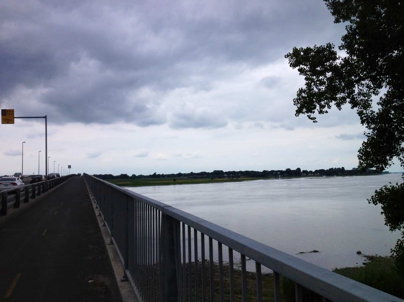
And even when the route must use part of a road, plastic bollards have been installed to keep cars off the bike paths. How welcome.

20120804-224508.jpg

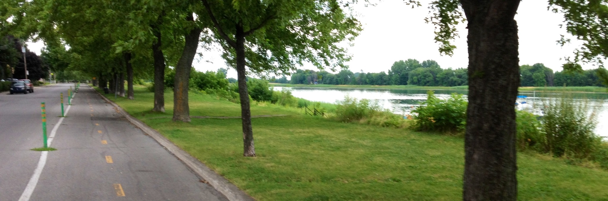
When I get close to Lachine Canal, I get a dedicated path once again.

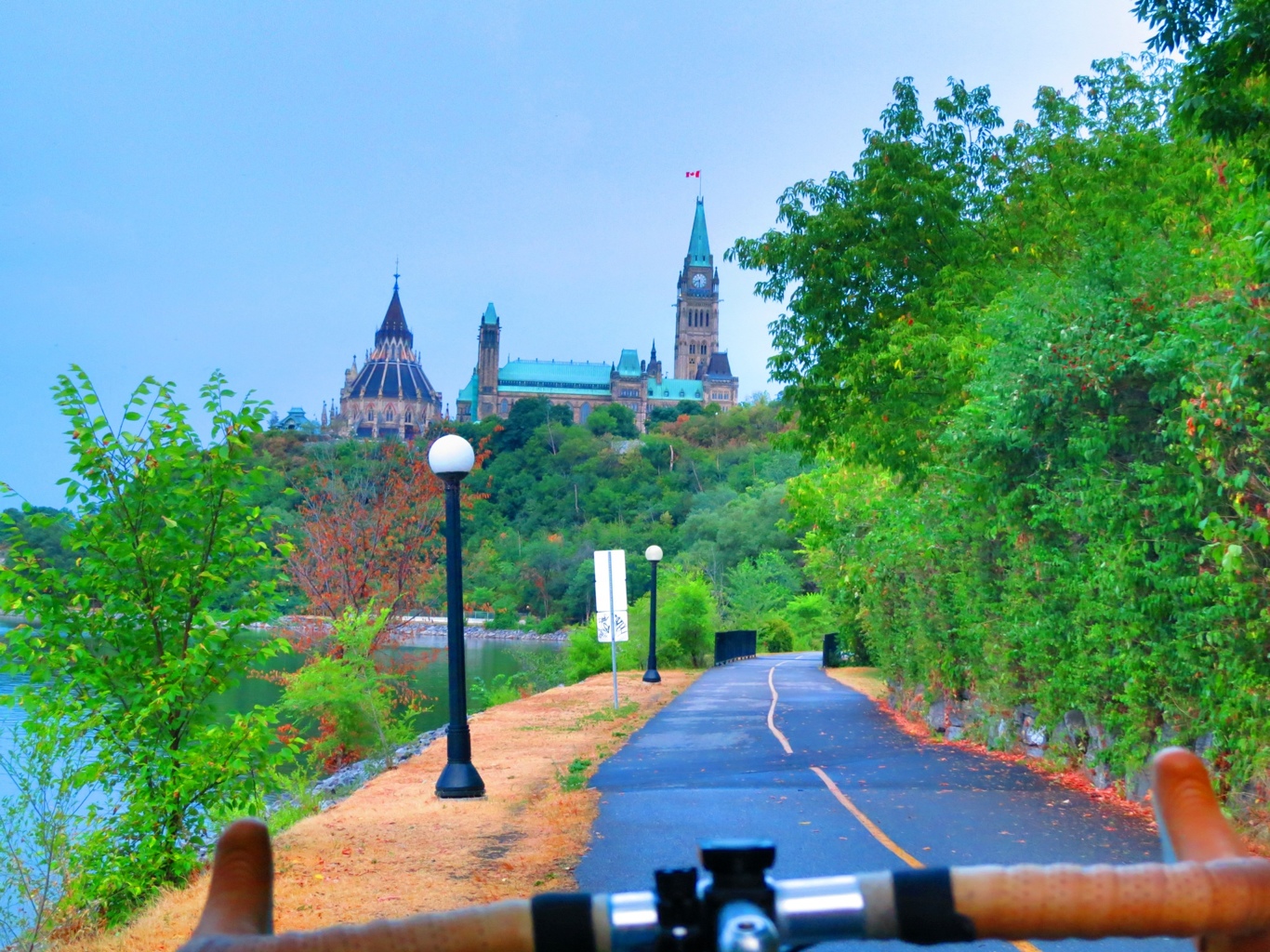
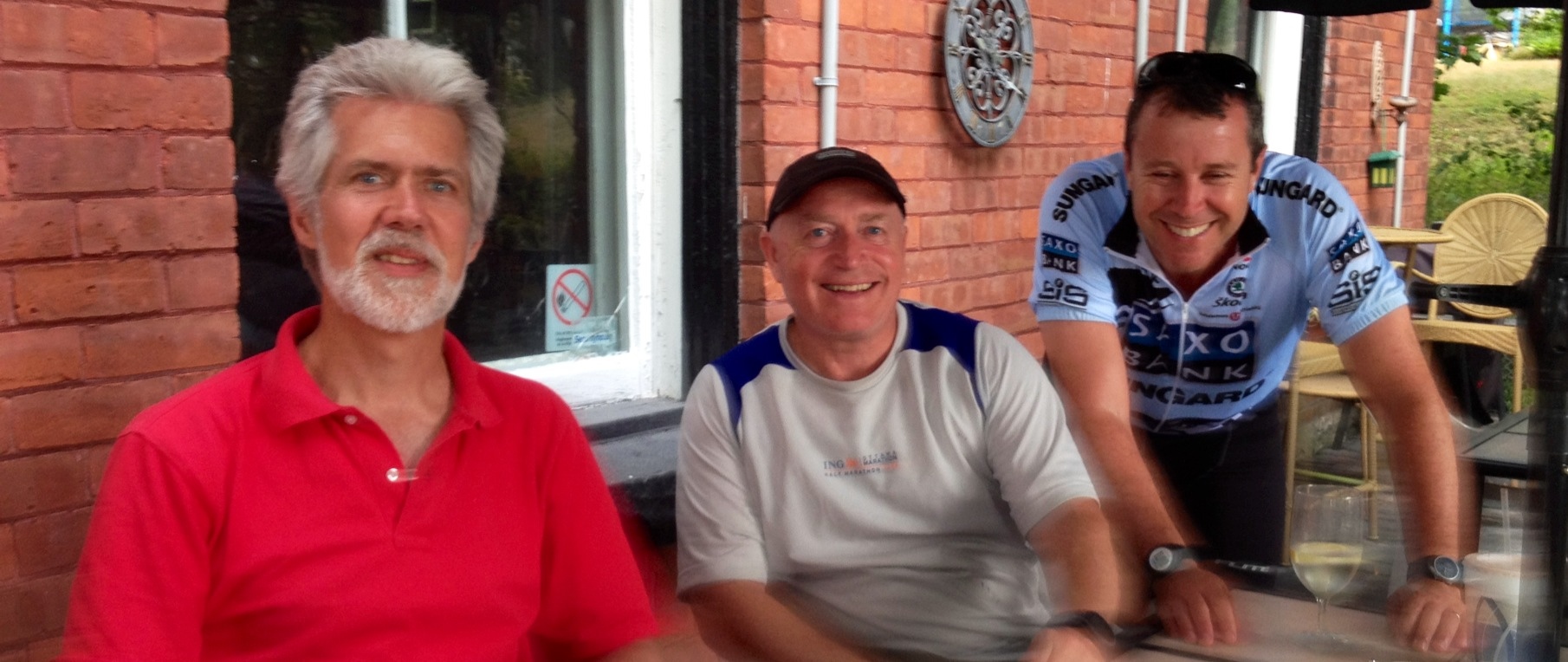
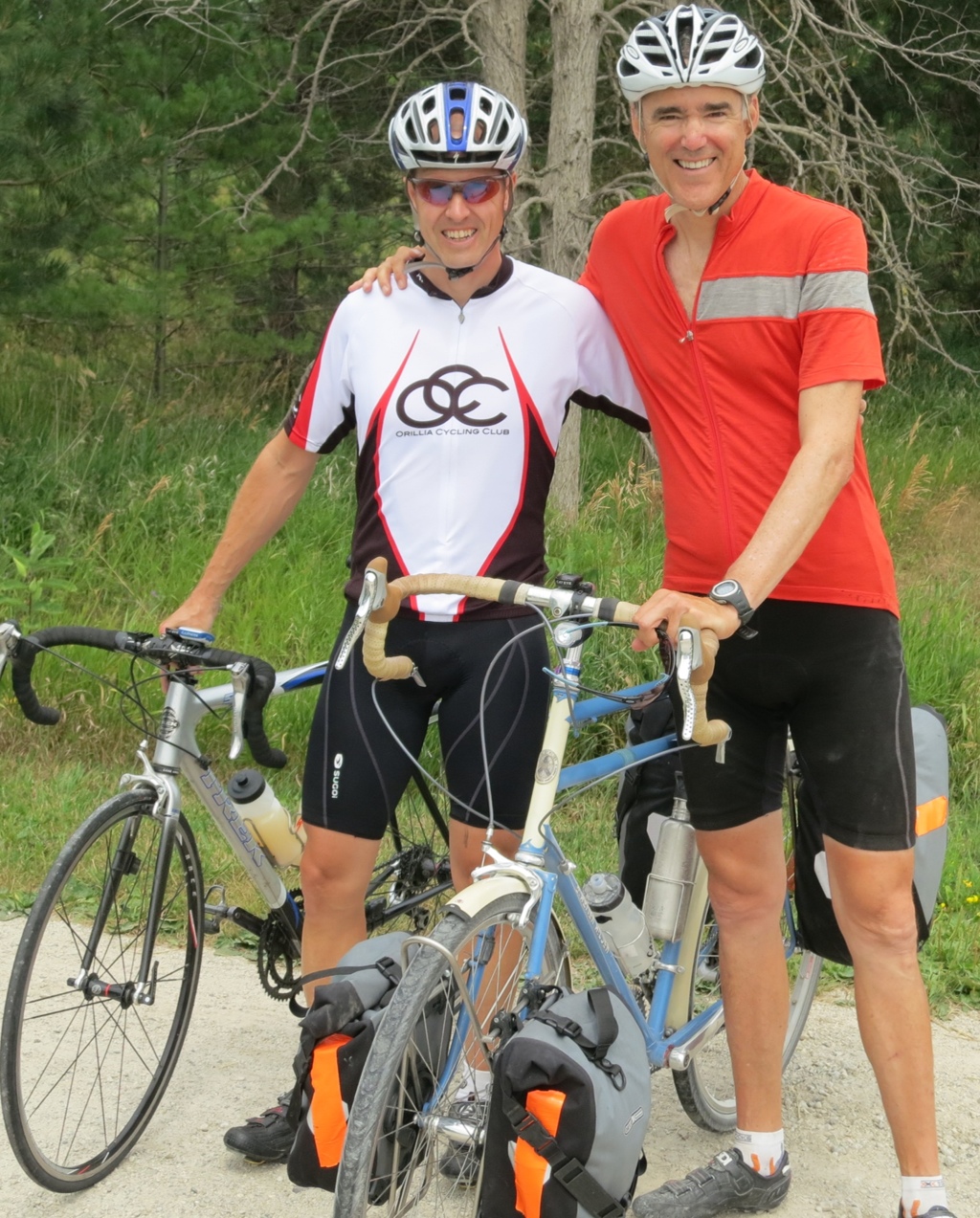
Shortly after reaching the canal, I am met by a big goggle-wearing Pearson alum, Mike Watson, Pearson Year 20. The goggles are to protect the eyes from the bugs that sometimes swirl around the canal this time of the evening as Mike was kind enough to guide me into the city. It takes us a while to reach the heart of the city and our efforts to find a restaurant still serving meals proves to be a challenge we did not anticipate. It is not until about midnight before we are fed. We then make our way to the home of another Pearson alum, Benoit Charlebois, Pearson Year 9, who has offered me a place to stay for the evening.

A long fun day from the countryside to the city.

Stats – for Wednesday 25 July 2012

Start: Hawkesbury
Finish: Montreal
Distance: 120 km
Time on Bike: 5 hrs 26 min
Average Speed: 20.2 km/hr
Distance to Date: 6025

Along the Ottawa River

20120804-193434.jpg

I leave Ottawa after having a delightful catch-up breakfast with two recent Pearson alumni, Andrea Abbott, Pearson Year 35, and Laurence Jutras Year 36. Both are continuing their university studies and traveling extensively around the world.

The route out of Ottawa is just as peaceful and as beautiful as the route into the city from the west. The trail is along the south shore of the Ottawa River and I feel like I have the river and the pathway all to myself.

20120804-191250.jpg

20120804-191424.jpg

I love these dedicated trails so much I had to take a few videos.

After the trail ends, I follow the route as described by another cyclist. I am pushing to see if I can make it about halfway to Montreal along back roads as close to the river as possible.

As I push on into the early evening, the heat of the day has created a threatening looking cloud bearing down on me. When I see it getting closer it is a real inspiration to pedal harder.

20120804-192348.jpg

This one doesn’t catch me and I make it all the way to Hawkesbury.

Stats – for Tuesday 24 July 2012

Start: Ottawa
Finish: Hawkesbury
Distance: 124 km
Time on Bike: 6 hrs 43 min
Average Speed: 18.4 km/hr
Distance to Date: 5,905

Parliament Hill

20120803-230115.jpg

I plan a bit of a rest day with the idea of getting east of Ottawa by evening. I have the great pleasure to have lunch with our former Prime Minister and current Pearson College Trustee, the Right Honourable Joe Clark. As always, it is a delight to have such wide ranging conversations with him. His work with the Global Leaders Foundation is impressive and is a quiet force of support where it is needed in the world. And this fits in well with the book he is writing, to be titled: “Lead from Beside.”

I also have the chance to tour the IB World School, Academie de la Capitale, founded by Lucie and Francois Jacques. An ambitious project already making a big difference in the lives of the students who get to learn following a truly experiential approach in an intimate setting.

It is late afternoon by the time I get my bicycle all packed and ready to go. The very hot day has produced some wild thunderstorms so I wait them out patiently and follow their path on weather radar. With the skies clear in the direction of Ottawa I set out to get east about 40-50 km along with a stop on Parliament Hill.

After only a few kilometers, the sky darkens and I get caught in a wild downpour, complete with thunder, lightening, a bit of hail and a few flash floods. I manage to find refuge beneath an overpass and decide to wait.

20120803-223550.jpg

The wait is well worth it as it becomes much cooler and I get to enjoy that lovely smell of the air after a summer shower. And I also get to enjoy the bike path along the Ottawa River into the city.

20120803-224721.jpg

The pathway into the city is full of surprises, things you would not expect so close to the nation’s capital.

Pastoral views of the river.

20120803-230803.jpg

Including one painted on the side of a tree.

20120803-230943.jpg

And places to swim.

20120803-231224.jpg

And fish.

20120803-231332.jpg

And create sculpture from rocks exposed when the river level drops in the summer. Art to enjoy until the river rises again.

20120803-231602.jpg

20120803-231701.jpg

20120803-231752.jpg

I approach Parliament Hill from behind but nonetheless, an impressive sight and feeling.

20120803-232250.jpg

It is getting dark by the time I am in front of the Parliament building and I try unsuccessfully to set up a time delayed photo but I do get something. It is a different feeling arriving here by bicycle from the west coast. With the sun set, I decide to stay in Ottawa for the evening.

20120803-232751.jpg

Stats – for Monday 23 July 2012

Start: Nepean
Finish: Ottawa
Distance: 19 km
Time on Bike: 1 hr 13 min
Average Speed: 15.2 km/hr
Distance to Date: 5,781 km

Alumni Gathering

I have nearly 100 km to go to get from Renfrew to Ottawa, the humidex is over 40 for the day, there are several forrest fires burning along the way, I don’t really have a route and I need to be fresh for an alumni gathering at about 6 pm. Oh my.

I start with a good breakfast and an idea of a route suggested by a Pearson alum, Lucie.

All starts well and I manage to find back roads without difficulty. Much of the route is alongside fields of wheat, canola, strawberries and more. The Ottawa river valley is quite fertile.

20120801-213339.jpg

20120801-213439.jpg

Labourers are picking strawberries in oppressive heat. I wonder where they are from.

20120801-213713.jpg

After about 50 km I get my first glimpse of the Ottawa River. This and the St Lawrence River will be my companions for the next several days.

20120801-214024.jpg

I am not completely confident about the second half of my route into the city so when I see three Lycra clad cyclists coming from that direction, I wave to them and ask for advice.

Turns out they are on a mid-day ride from Ottawa into the countryside and back. After trying to give me directions, they ask me to join them. I only have to backtrack about one kilometer then they show me roads that barely appear on a map. After about an hour together, we have all run out of water and are in need of a break.

The trio take me to the town of Carp and the restaurant, The Swan. I am treated to lunch and drinks. The restaurant is next to a very active fire station, busy fighting brush fires. The fire department has to fill its trucks so often, the restaurant does not have enough water pressure to have running water.

20120801-215741.jpg

Another nice coincidence is that one of the cyclists lives in the same neighborhood as Francois Jacques, the Pearson alum who is hosting the alumni gathering.

My escort to Ottawa continues after lunch and I make it in time for a quick shower and I am delightfully surprised to find fifteen alumni at the pot luck gathering. What a great welcome.

20120801-220256.jpg

The evening is full of great conversation. It is inspiring to see what the alumni are doing. I continue with my video project interviewing UWC alumni about the impact of their college experience on their lives. I hope to turn this into a documentary in the fall.

Stats – for Sunday 22 July 2012

Start: Renfrew
Finish: Nepean (just west of Ottawa)
Distance: 91 km
Time on Bike: 4 hrs 30 minutes
Average Speed: 20.3 km/hr
Distance to Date: 5,762

Canadian Shield Redux

20120731-210319.jpg

Another hot day of up and down cycling through the Canadian Shield. Sometimes I am asked: Where have you encountered the toughest hills? The answer may surprise you. There have been two so far. One was today just before the town of Denbigh. It was about two or more kilometers long much of it at a 12% grade or higher. The road was newly paved, which made it smooth but also stifling hot. The other crazy big climb was just before the town of Inglis just after crossing the Assiniboine River in Manitoba. Yup, Manitoba.

The road flattens out about 40 km outside of the city of Renfrew. It is a day of getting in the distance, staying hydrated and, whenever possible, out of the sun. So few photographs on this hazy hot day on the Laurentian Plateau. But one concluding sunset in Renfrew. I am getting closer to another big milestone. Parliament Hill.

20120731-205913.jpg

I work hard all day to make it so that Ottawa is within striking distance the next day.

Stats – for Saturday 21 July 2012

Start: Bancroft
Finish: Renfrew
Distance: 134
Time on Bike: 6 hrs 51 min
Average Speed: 19.4 km/hr
Distance to Date: 5,671 km

Crossing the Canadian Shield

20120731-140354.jpg

Mike Gordon leads me out of Orillia in the morning and shows me the trails and back roads to the relatively rural route, Route 45, that will take me all the way to Ottawa. It is a hot day with a fairly strong headwind. Mike is gracious enough, and in great shape too, to allow me to draft behind him for the first 25 km. He gives me lots of cycling tips and I follow his advice and raise my seat and my cadence. They both made a difference. I have a challenge ahead of me because Ottawa is about 400 km away and I have given myself only three days to get to an alumni gathering that will take place there.

20120731-141142.jpg

After Mike leaves me I literally have to, as Mike says, make myself small against the headwind. It is tough to do given the wind drag of the panniers. And it is tougher still, at least psychologically, to go through towns with names like these.

20120731-141552.jpg

I pedal away and drink in so many liters of liquids I feel my organs should all be swimming but the thirst is just endless. The route takes me through the Canadian Shield and becomes hillier and hillier.

I have one more near crash related to fresh asphalt. I had no way of knowing, and there was no signposting or asphalt smell but apparently earlier in the day a road crew was filling in deep cracks in the road shoulder. So when I hit this patch, I sunk and over I went but once again miraculously got my foot out of the pedal cleat in time to catch my fall. I have been keeping my pedal cleats clean and lubed so I am happy. You can see from the photo how deep I sunk in the soft asphalt. And I was very lucky to be going slowly uphill.

20120731-145028.jpg

The towns here, high in the Laurentian Plateau, are aptly named.

20120731-143606.jpg

I am a bit wiped out but very happy to make it all the way to Bancroft, a hilly hot one hundred mile day of cycling. I cross the bridge over the river leading into the town just as the sun is setting.

20120731-143826.jpg

Stats – for Friday 20 July 2012

Start: Orillia
Finish: Bancroft
Distance: 159 km
Time on Bike: 8 hrs 25 min
Average Speed: 18.8 km/hr
Distance to Date: 5,538 km

Secret Back Roads

I get a grand tour of Meaford in the morning by John Barker, whose family has a long history on this part of Lake Huron, starting with the apple business. Wonderfully, I get to have a peaceful start for the first 35 kilometers from Meaford to Collingwood. A former rail line has been transformed into a well groomed bicycle path from one city to the other.

The only challenge was the first kilometer where the trail was getting a fresh layer of crushed limestone, which had yet to be compacted.

20120730-161548.jpg

20120730-162620.jpg

It is a beautiful trail where the trees often form a protective canopy for the rider.

20120730-162932.jpg

The trail has a nice simple signage system, something I would love to see on other bike trails.

20120730-163414.jpg

And Collingwood has a nice bike themed mural.

20120730-163547.jpg

After Collingwood, I follow county roads through farms and battle a bit of a headwind and heat.

20120730-163212.jpg

After cycling about 60 km, I am met by Pearson Year 14 Alum and Pearson College Trustee, Michael Gordon. He is a serious competitive cyclist who shows me a back roads route to his home in Orillia. He trains many hours on these roads and hills and he nearly placed first in a recent 100 mile race on these very same roads.

20120730-164121.jpg

It was a long hot day on the road as evidenced by the crusts of salt on the back of my cycling jersey.

20120730-164342.jpg

I get replenished with a lovely dinner with Michael and his partner, also a Pearson Alum, PC Year 15, Michelle Gordon. We take a walk later through the very alive city of Orillia, with a beautiful marina and collection of parks and trails.

20120730-164726.jpg

Mike and his son, Matthew, pose with their faces in holes on a painted sail.

20120730-164914.jpg

And the sun sets after a long day and I head off soon to sleep.

20120730-165101.jpg

Stats – for Thursday 19 July 2012

Start: Meaford
Finish: Orillia
Distance: 129 km
Time on Bike: 6 hrs 45 min
Average Speed: 19.1 km/hr
Distance to Date: 5,379 km

Another Double Century

20120730-120006.jpg

Actually now that I am taking a rural collection of roads to Ottawa, there are few if any rough spots ahead.

A delightful and early start in Tobermory with Bill and Judy Caulfield-Browne, my hosts for the evening. They set me on my way with a healthy and filling breakfast and great conversation about a wide range of subjects. They are both serious conservationists, lovers of nature, travelers and Bill is a serious nature photographer. I take the only road south from the top of the peninsula, Route 6, which has a modest shoulder but is newly paved.

At a coffee shack, I end up in a long conversation with a retired mental health worker who tells me her life story, which included herself being placed in an institution as a child then her working in one doing menial tasks then misrepresenting her qualifications, discovering her learning disability, compensating for it, going to university, then having a full career in mental health services retiring with a reputation of having the most effective approach as a care giver, someone all of her bosses consulted when they were challenged.

I am delighted to see several dedicated mountain bike trails along the route and although my bike could not handle the terrain, the people maintaining them give me good advice about where to eat and where to ride on my way to Meaford.

As soon as I am able, I take a side road east so that I can be cycling along the shores of Lake Huron. I follow the route recommended for motorcyclists. Turns out the road I take is exactly halfway between the north pole and the equator.

The route along the water is nearly free of traffic.

20120730-121223.jpg

20120730-121323.jpg

All the coastal route options of the day add much more distance than I realized so I end up covering over 100 miles before I make it to Meaford, where Mike Gordon has set up another place to stay for the evening, with the delightful host, John Barker. It is great not to have to set up a tent after such a long day on the road.

Stats – for Wednesday 18 July 2012

Start: Tobermory
Finish: Meaford
Distance: 164 km
Time on Bike: 8 hours 4 min
Average Speed: 20.3 km/hr
Distance to Date: 5,250 km

South to Safe Country Roads

20120728-214552.jpg

So I wake up in Little Current, a town in the northern part of Manitoulin Island. I make a quick call to an avid cyclist and Pearson College trustee, Mike Gordon. Within a few minutes he has a route sorted for me for the day as well as lodging for the evening set up. He had been wondering when I would come to my senses and choose a route that did not include the Trans Canada Highway. I have a very simple goal for the day, to cycle to the southernmost tip of the island to catch a ferry to Tobermory on the Bruce Peninsula of Lake Huron.

The island has very little traffic and has a peaceful remote feeling. There is also evidence of a good sense of humour.

20120728-214826.jpg

20120728-214942.jpg

20120728-215125.jpg

After about 20 km south of Little Current, Route 6 is repaved with a nice shoulder to ride on and signs about sharing the road, the first such signs that I have seen in weeks. Reassuring.

20120728-215500.jpg

On my way south, I am passed by a lone cyclist going north and I get asked where I am coming from and I say Victoria and she says happy cycling. After another kilometer or so, she turns around and catches up to me and introduces herself. She and her partner are teachers on the island and she shows me the way to a local restaurant for an unusually healthy meal of grilled whitefish with vegetables. I learn all about the challenges of teaching students on an island that is a remote place to grow up with little connection to the world beyond.

Even though I had plenty of time to get to the ferry, with all this conversation, I almost miss it. And not just the conversation. The ride to South Baymouth is so pleasant, I slow down to enjoy it.

And even though I have been living on an island myself for the past six years, I always get a sense of excitement when I board a ferry. So I take a few photographs and even a video as I board and as we sail to Tobermory.

20120728-222031.jpg

All tied up like a horse for the journey.

20120728-222105.jpg

20120728-222213.jpg

20120728-222312.jpg

I land in Tobermory about an hour before sunset and the family hosting me will not be around until later in the evening. I find a fish and chips place in the town and after dinner in the protected harbour, I notice how stunning the sky is as the sun sets.

20120728-222907.jpg

Watching the sky get more and more colourful, I run quickly to the other side of the peninsula and get to see what is for me an unusual pumpkin coloured sunset. Not sure if this happens all the time over Lake Huron.

20120728-223153.jpg

Stats – for Tuesday 17 July 2012

Start: Little Current
Finish: Tobermory
Distance: 68 km
Time on Bike: 3 hrs 7 min
Average Speed: 21.8 km/hr
Distance to Date: 5,086 km

Trans Canada Root Canal Treatment

After a long ride into Canada the day before, I am slow getting away. Not only did I need a good sleep having cycled in after midnight, I took time to devour the offerings found in a substantial buffet. When entering Canada the night before, the immigration officer sent me to the Delta Hotel. It was a few grades above anything I have stayed in the whole trip, especially what they call breakfast.

Only on a bike trip would I take a photo of a buffet.

20120726-230032.jpg

Before getting out of the city, I visit a bike shop to get my Speedplay Frog pedals greased. It takes a special grease gun and the first shop I go to has one. The pedals are working well but they have needed greasing every 1,500 km or so. I also get advice on the best route out of Sault Ste Marie and a few warnings about staying off the Trans Canada Highway. The good advice and free pedal greasing I got from Paul at Algoma Bicycle Shop.

20120726-230622.jpg

I head out of town and find 17B, which runs more or less parallel to the Trans Canada 17. The 17B cuts through a first nations community. A sign painted on a railway bridge makes this clear.

20120726-231248.jpg

After the town of Echo Bay I head east on hilly rural road number 638. This winds and winds but is wonderfully peaceful.

20120726-232132.jpg

20120726-232223.jpg

20120726-232430.jpg

About fifteen kilometers from the town of Bruce Mines, I hit the Trans Canada Highway for the first time on the trip. From the back roads I had been on earlier, it was the sensory equivalent of going from having a massage to having a root canal. Trucks were barreling by about 110 km/hr and for the cyclist, there was no shoulder whatsoever. Only a white line and even that was crumbling.

20120726-233120.jpg

If two vehicles passed at the same time, one in each direction on this two lane undivided highway, there was no room for a cyclist and it was impossible to ride on the rough gravel shoulder. Often on corners, I could see the wheels of trailers crossing the white line ahead of me and churning up the gravel. There was no way I was going to cycle on this all the way to Ottawa. I made it to Bruce Mines totally depressed and puzzled about what to do. I re-read some cross country cyclist blogs and the first one described nearly getting hit on this same stretch and literally crying the next day.

It is clear the alternative is to head south to Manitoulin Island then ferry to Tobermorey and take rural roads all the way to Ottawa. But it means adding about 300 km and I am at least 200 km from the turnoff from the Trans
Canada towards Manitoulin Island. So I have dinner in Bruce Mines at a wonderful Indian restaurant that is part of the local gas station then I go to the shore of the lake and meditate on my little problem.

I decide to try an experiment and see if I can hitch a ride to Manitoulin Island and restart the journey from there. If I get a ride down the Trans Canada to the town of Espanola I will avoid the insanely dangerous, essentially shoulder-less Trans Canada.

So I go back to the gas station to try my luck. The fist vehicle to pull in for gas is a man in a pick up truck. I approach him and ask if he is heading east. He said he was going to Manitoulin Island that night and that he would be happy to give my bicycle and me a lift. Wow. The root canal is over.

I take a photograph from the cab of the truck. The shoulder gets just marginally better after Bruce Mines, about the size of a shoebox.

20120726-235841.jpg

20120727-000045.jpg

I add to my life list of things to do: Discourage cyclists from riding on the Trans Canada Highway. I think it should be banned. So I will begin with a warning to sensitive readers, I am about to put on the caps lock key. CYCLISTS: STAY OFF THE TRANS CANADA HIGHWAY. PERIOD.

Stats – for Monday 16 July 2012

Start: Sault Ste Marie, Ontario
Finish: Manitoulin Island (driven from Bruce Mines)
Distance: 72 km (to Bruce Mines)
Time on Bike: 4 hrs 2 min
Average Speed: 17.8 km/hr
Distance to Date: 5,017 km