Back into Canada

I set out today determined to cross back into Canada by midnight. After being caught by a storm the day before, I have over 175 km to get to the bridge between the US and Canada and the two cities of Sault Ste. Marie. It is a hot day and I take several breaks along the way to stay hydrated including a long lunch to eat a large pizza.

I get to see several Sandhill Cranes along the way, a bird I have not seen before.

20120723-110405.jpg

Outside the relatively small town of Newberry, they list an amazing array of choices for formal worship.

20120723-114057.jpg

And someone has placed a mailbox in front of all the signs that only a supernatural being could deliver mail to. Even Dikembe Mutumbo could not reach this.

20120723-114207.jpg

I follow route 28 most of the day but as it gets closer to Sault Ste. Marie, the shoulder gets narrower so I cut up north on route 123. Like the urinal with the Jane Fonda sticker in it, signs continue to suggest this is conservative territory.

20120723-115935.jpg

This also leads to a peaceful scenic drive along Lake Superior, the Whitefish Bay Scenic Byway through the Hiawatha National Forest. I find the historical plaques leave out a lot of history. They make no mention of any inhabitants of the area around the lake before it was discovered.

20120723-113439.jpg

The scenic drive leads to a US Indian reserve and is completely free of traffic.

Then one arrives at the massive Bay Mills Casino and a little while later to a sacred burial ground. What contrasts.

20120724-112600.jpg

20120724-112651.jpg

I keep pedaling towards Sault Ste Marie well after sunset. My plan is to go over the bridge close to midnight when there is hardly any traffic. There are no lanes for bicycles and there is no shoulder so that, I think is safest. The lady at the bridge toll booth agrees with me and sends me over with a wish of luck.

20120724-113213.jpg

And here is another amateur attempt to capture something by video as I cross the bridge.

Stats – for Sunday 15 July 2012

Start: Seney, Michigan
Finish: Sault Ste. Marie, Ontario
Distance: 178 km
Time on Bike: 9 hours 8 minutes
Average Speed: 19.8 km/hr
Distance to Date: 4,945 km

Penultimate Day in USA

20120719-233315.jpg

With hot sunny days upon me, the sun bakes me out of the tent once again and into the swing set I camped under the night before. I set a goal for myself to make my way back into Canada in two days, crossing from one Sault Ste. Marie to another. That means about three hundred kilometers by the end of the day on Sunday. I follow route 28 all day with its modest road shoulders. I decide to wear my orange reflective vest as my shirt for the day to make myself more visible.

Early in the day the ride takes me along the quiet shores of Lake Superior.

20120719-233635.jpg

One curious thing on these roads is that they put a special surface on them where snowmobile paths cross. I have no idea what this special covering does and it is hard to imagine all these snowmobiles crossing a main highway in so many different places.

20120719-234120.jpg

I come upon a park with the most curious set of signs. It may require reading multiple times but clearly the owner of the park has had his park shut down by local authorities and he is taking revenge on them.

20120721-224656.jpg

20120721-224939.jpg

I am determined to cycle about half the distance, about 150km, to the town of Newberry. About fifty kilometers away I notice a woman in a convertible going in the opposite direction pulled over on the side of the road. I soon figured out she did so to put the top on her car. For hours I have only been looking east and seeing something like this.

20120719-234657.jpg

When I turned around to look west, I understood why she was preparing for rain.

20120719-234807.jpg

As it was about 20 km to the nearest town, and I was quite exposed on the highway, I picked up the pace to try to beat the storm to the next town where I could find some shelter. It’s great to have a shot of adrenaline after cycling 100 km or so. As I hear the rumble of thunder coming closer, I move even faster.

Within 30 minutes or so the storm is above me.

20120719-235318.jpg

20120719-235359.jpg

Fortunately, the storm and I reach the town of Seney at the same time so I am able to get shelter at the Fox River Inn where I decide to spend the night.

There is a single bar in town that also serves food so I head over for a hamburger and fries. Basically, that was the menu. It was a politically conservative place full of signs like “Charlton Heston is my President” and something that I noticed in the washroom urinal, actually you can’t miss it. I find it amazing that more than forty years after Jane Fonda was protesting against the US involvement in the Vietnam war, this little bar in upper Michigan is still taking the piss out of her.

20120721-223954.jpg

Stats – for Saturday 14 July 2012

Start: Chcolay Townsip, Michigan
Finish: Seney, Michigan
Distance: 113 km
Time on Bike: 5 hrs 19 min
Average Speed: 21.2 km/hr
Distance to Date: 4,767 km

Wheel Pick Up

Remember the cracked rim? It is still riding perfectly but it is an ever present worry if a spoke snaps through. I get an email tracking the delivery of the rim from California to Kentucky to Michigan and see that it will arrive today in Sault Ste. Marie.

As I awake a wee weary from a hot 166 km ride the day before and as the UPS Store is not open on Sunday when I plan to arrive in Sault Ste. Marie, I decide to rent a car and pick it up.

Of all days for Google Maps to fail me… It sent me to the car rental location on the wrong side of the city. East instead of west. A detour of some 17 km or so. The good news is that when I called the agency, Enterprise, and said there is no office here, they apologized and sent a car to pick me and my bicycle up.

After this delay and the drive to Sault Ste. Marie and back, there was hardly time for much riding. But I did want to try the new wheel.

So after assembly and an hour before sunset I head east once again and follow a newly paved bike trail along the shore of Lake Superior.

20120719-110359.jpg

The trail markings note it continues for 12.8 miles so I decide to take it to the end and find a place to pitch the tent for the night. Unfortunately, after about five miles it turns into a gravel path on an old railway bed. I manage this for a few miles then start spinning out in areas where ATVs have made a mess of the path.

So I scramble and find a children’s playground in the dark and settle in for a good night sleep.

20120719-110935.jpg

Stats – for Friday 13 July 2012

Start: Marquette, Michigan
Finish: Chocolay Tow ship
Distance: 28 km
Time on Bike: 1 hr 46 min
Average Speed: 15.7 km/hr
Distance to Date: 4,653 km

Two Hot Centuries

20120717-184307.jpg

Hottest day so far. Mid- 30s Celsius. As soon as the sun rose it baked the inside of the tent and forced me out early. An eye mask can keep out the light but not the heat. Smooth hot cycling through the day with that curious view ahead of heat rising off the pavement that looks like waves of water.

At a rest stop I meet a group from the southern part of Wisconsin who are on a loud, dusty All Terrain Vehicle – ATV – tour through the trails that often line the highways here, the same trails that are used for snowmobiling. I am confident the group thought I was nuts but I think I share the same thoughts about them. They plow through dusty and sometimes muddy trails and, except for the person in the lead, they can hardly see anything but a dust cloud. The noise is deafening and they scare off all the wildlife. It’s like we are from different tribes.

20120717-183355.jpg

20120717-184425.jpg

Through this rural part of northern Wisconsin, there is a small town about every 20-30 km or so but most are full of boarded up buildings and for sale signs are everywhere. In this beautifully named town, the library is only open two hours per week. At least it has one.

20120717-184816.jpg

And there are signs that the weather is very different at other times of year.

20120717-184942.jpg

And maybe this is the reason for the affinity with other northern countries, whose people came here to settle during the time when iron mining drove the local economy.

20120717-185231.jpg

I keep on pedaling through the heat, being mindful to stay hydrated. I marvel at the biochemistry that must be at work to convert liters of water, Gatorade, chocolate milk, coffee and oranges into what comes out of the pores of my skin, which then leaves a salty crust over everything I am wearing. And soon I enter another state.

20120717-185948.jpg

Michigan has done a much better job of branding and promoting its own northern reaches. This area is now called the Upper Peninsula or the U.P. and people here are called Yoopers.

The roads are in great shape and the area is dotted with lakes.

20120717-190407.jpg

But their small towns are also closing up and another common sight is an abandoned high school, this one from the sonorous town of Michigamme. Many of these have become untouchable monstrosities as they are filled with asbestos.

20120717-191230.jpg

Without Leisa with me, I spend more time cycling so I end up doing a kind of double century, pedaling first 100 km then eventually reaching 166 km or just over 100 miles all the way to Marquette on the shores of Lake Superior. It is great to be on a shoreline again. But before I get to anything beautiful, like the approach to any town or city in the US with a reasonable population, I have to go through the mess of strip malls and big box stores. Collectively, not only are they ugly, they sell lots of stuff we really don’t need and they suck the life out of once thriving small downtown businesses. These architecturally beautiful downtowns, where people used to get to know each other and where you can walk on sidewalks are economically crushed when Wallmart and its many kin come to their outskirts. And the only way to get to these warehouse sized stores is by car. So goes so many towns and so many good community habits with them.

20120717-192853.jpg

When I get past this ugly neon stretch, I go past Northern Michigan University. They have a great solution for parking bikes, one that other colleges and universities ought to consider.

20120717-193420.jpg

But something not to mimic would be signs like these. How did it ever get past admissions or first year student orientation committee?

20120717-200642.jpg

Oh well. Finally I get to the shore. How peaceful.

20120717-201002.jpg

The only sad ending to the day is that my bike fell over after I had it pose for that photo by Lake Superior. Right onto a rock and it scraped my trusty companion in three places. Well, a scratch or two had to happen sometime. Sorry bike.

Stats – for Thursday 12 July 2012

Start: Bruce Crossing, Wisconsin
Finish: Marquette, Michigan
Distance: 166 km (Canadian and US centuries)
Time on Bike: 8 hrs 10 min
Average Speed: 20.2 km/hr
Distance to Date: 4,625 km

Solo Once More

A sweltering day for cycling made even more difficult because I had to say goodbye to Leisa as she takes a marathon drive to Winnipeg to catch a flight home to Victoria and I put my head down and cycle east with a fully loaded bicycle on a rear rim with cracks in it.

I leave from Ashland on Route 2. Much of the road has a shoulder about the width of a hotel mini-bar refrigerator or one of those cheap dorm room fridges. So imagine lining up these narrow refrigerators end to end for about 150 km. Now, cycle on top of them for about six hours. If you fall off of them to the left, you will be in the way of cars and semi-trailers. If you fall to the right, you will spin out in gravel. Get the picture?

Here is a video to help. Taken at my favourite time of day with the sun going down and traffic too.

I keep pedaling and pedaling for a while after sunset not wanting to face the loneliness of being in the tent again longer than just a night’s sleep.

20120716-110516.jpg

I make it all the way to Bruce Crossing where there is a little camping area next to a baseball field. It even has showers. I find a place to pitch the tent next to the only trees in the park so that no motor homes drive over me in the morning as my tent is the same colour as the freshly mowed grass.

20120716-110825.jpg

Wheel update. Rivendell Bikes had planned on sending me a loaner wheel overnight but when they heard I would soon be heading back into Canada they instead did something even more generous. The wheel builder, Rich, built me a new, stronger wheel, a DT Swiss TK 540 rim, with the same White Industries M15 hub, and a new 8 speed cassette and sent it to Sault Ste Marie via UPS. He also said that when I finish the trip, he would rebuild my front wheel on a DT Swiss rim so that I would have a matched pair. The company with the cracked rim, Velocity, is backing all these changes because with a fairly light rider – now about 160 pounds, carrying about 25 pounds of gear on tires inflated about 50 psi – these cracks should not happen.

So I feel very much mechanically supported. Go Rivendell Bikes.

Stats – for Wednesday 11 July 2012

Start: Ashland, Wisconsin
Finish: Bruce Crossing, Michigan
Distance: 143 km
Time on Bike: 6 hrs 33 min
Average Speed: 21.7 km/hr
Distance to Date: 4,460 km

Rest Day Cracked Rim

20120714-204357.jpg

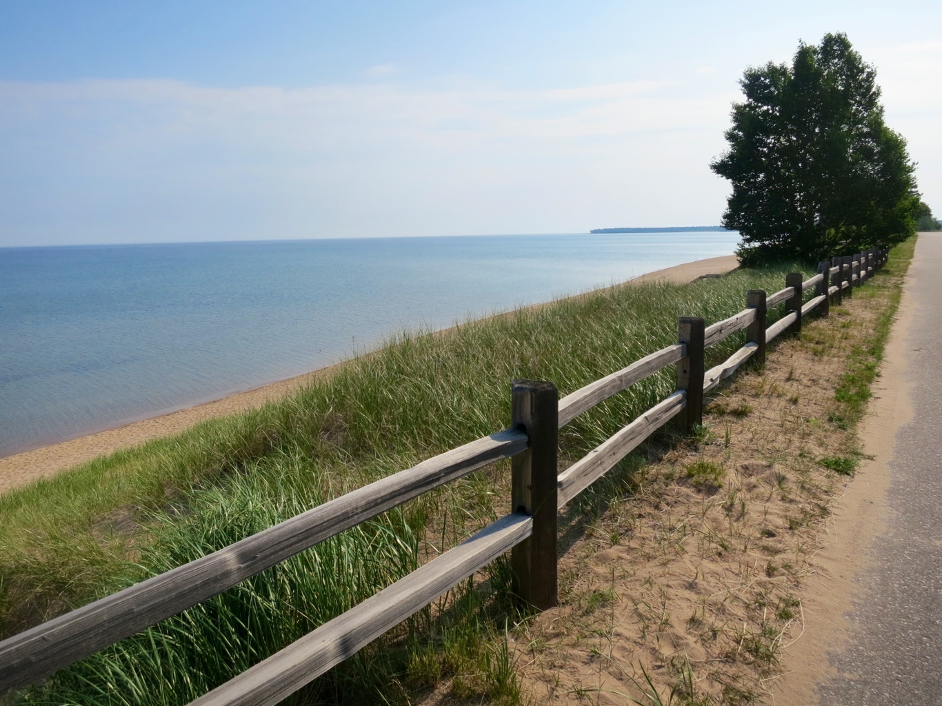
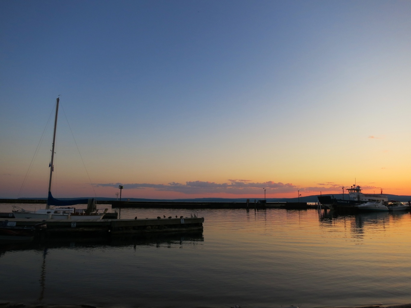
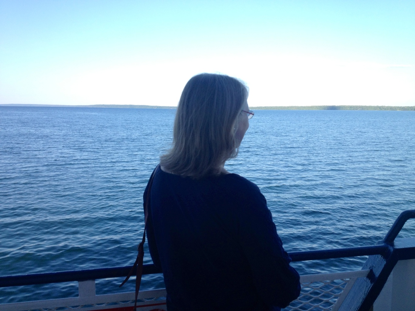
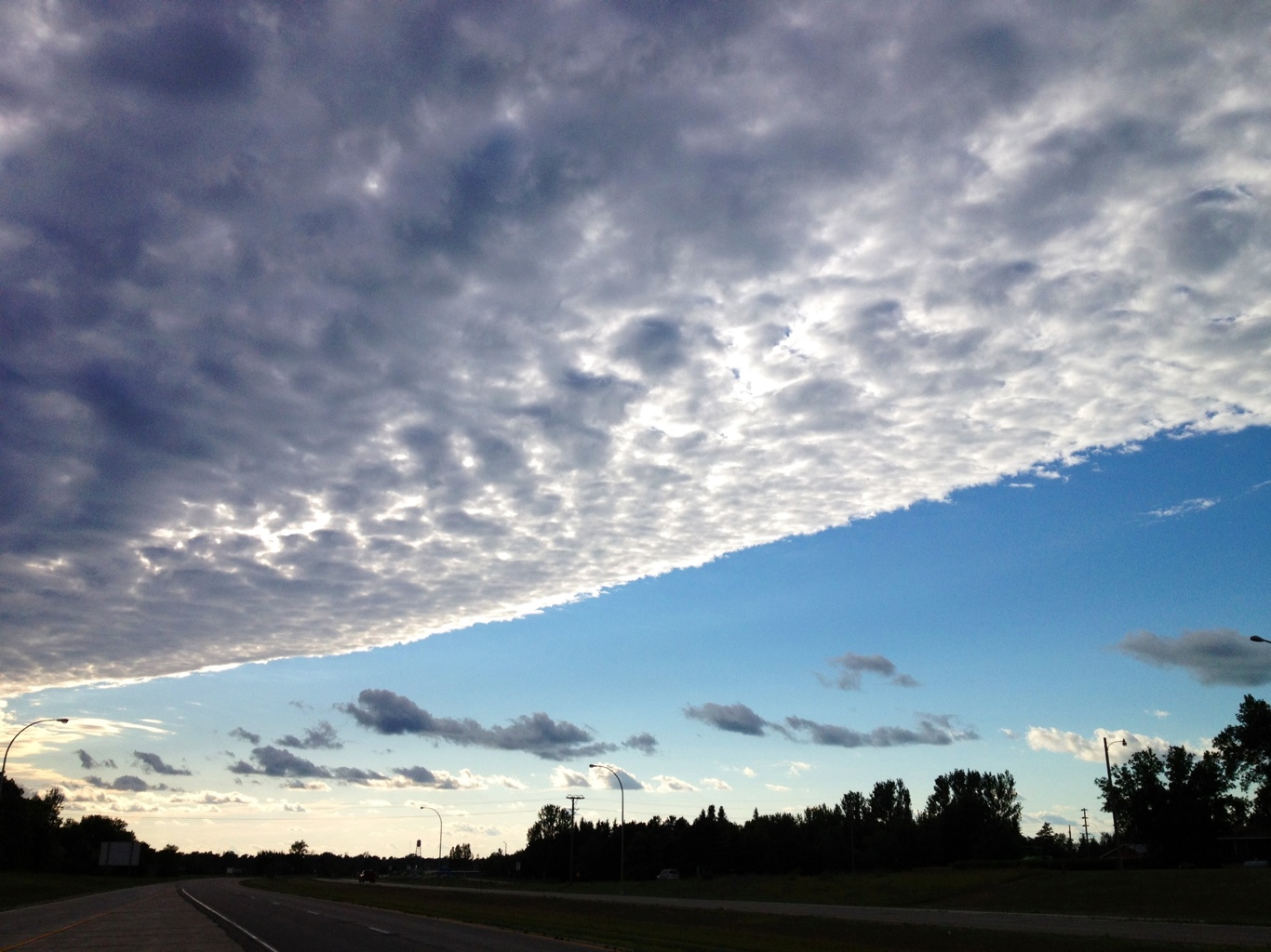
The rest day began with the sunset the night before. Being a lover of the ocean, every moment I am on Lake Superior, I realize it is just as beautiful and invites the same reflection as being on the coast.

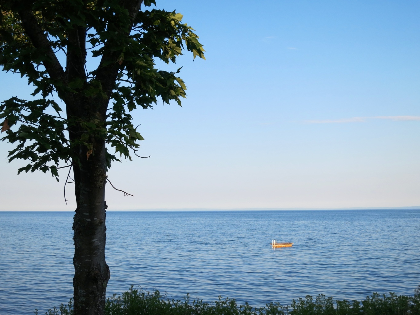
This little break, it turns out, is an opportunity for Leisa to reconnect with both the place and some of the people from her childhood. We make our way to the northern reaches of Madeline Island where Leisa spent some vacation time as a teenager. We find the same house where she last played in the sand and ocean circa 1973 and we find a family friend, now a high school teacher, vacationing there. The house has stayed in his family for four decades. When we first get there, no one is around so we swim in perfect temperature water for about an hour. What a great treat for my muscles. We play around this float and it feels like we are the first to discover the lake it is so remote here.

20120714-205857.jpg

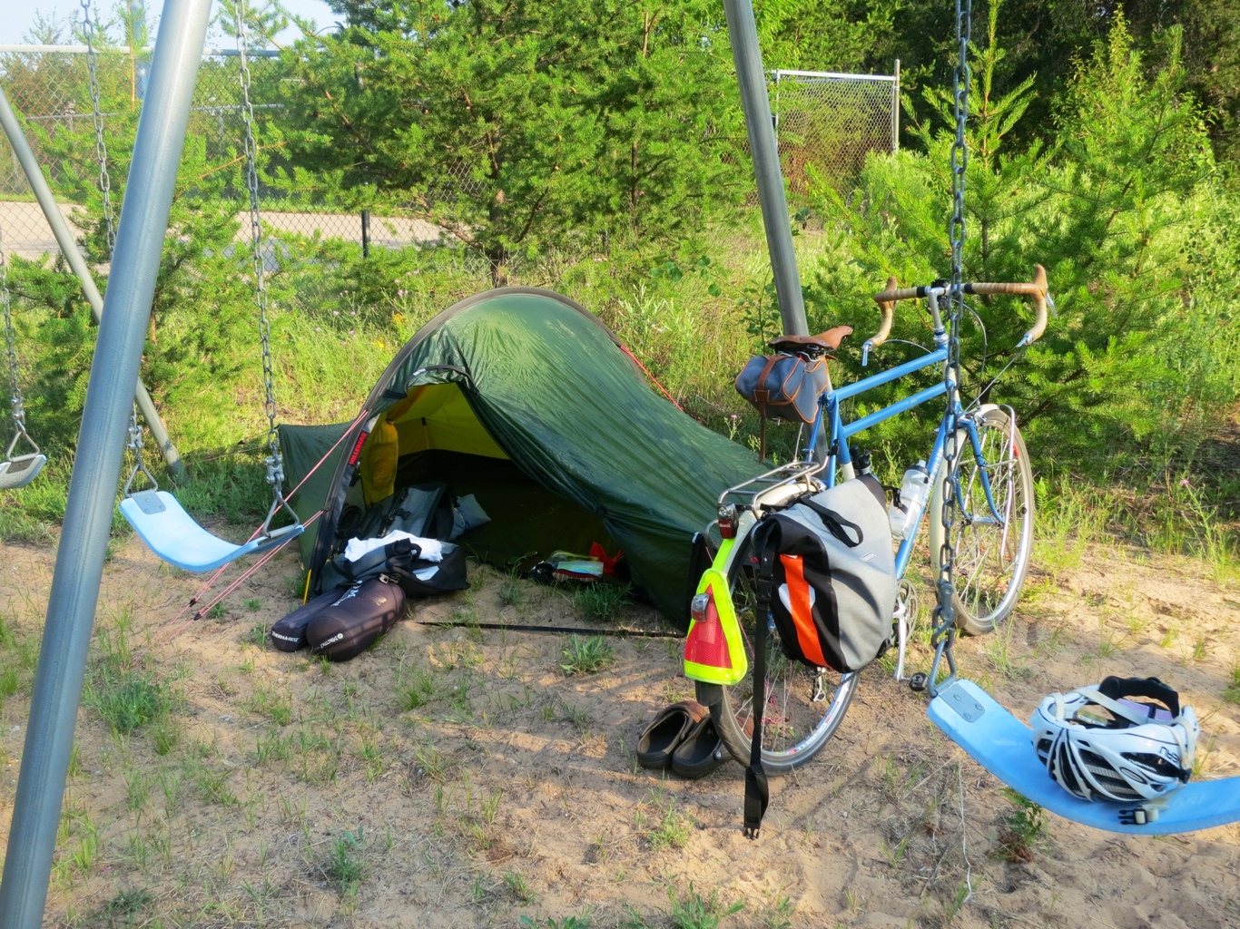
We return to our hotel to do a complete repack of my panniers and I go through every item looking to purge as Leisa will be leaving the next day and can take things back home. After checking likely temperatures for the remaining five to six weeks between here and Newfoundland, I find lots I think I can live without.

20120714-210628.jpg

I don’t have a scale to weigh it all but probably I will now be pedaling with about a kilogram or so less per kilometer.

Stuff I am sending home with the soon to depart sag wagon:

Mirror – never got it to work
Brooks seat cover – I decided to stay with the Selle An-atomica seat (gear reviews will start after I’ve ridden 5,000 km so stay tuned)
Extra headlamp (fingers crossed the remaining one does not go kaput)
Extra front blinking light (not as good as what I have on the bike)
Extra rear blinking light (can no longer be turned off)
Helmet blinking light (not bright enough for daytime)
Arm warmers (those stripy things)
Metchosin wool socks (they were great in the Rocky Mountains)
Skin cream (I am all broken in)
Proofide (leather cream for Brooks saddle)
Two tubes that have punctures (I still carry two new ones)
Down jacket (blue – folded into its pocket – a lifesaver in British Columbia in June)
Wool long sleeve shirt (orange)
Wool short sleeve shirt (blue)
Pair of wool cycling socks (going back with holes in them)
Extra chain
Roll of duct tape (orange)
Roll of twine
Vancouver Olympic Pin (gift from Tony Macoun – will be safer at the College)
Extra Water bottle
Water bag
Plastic bag for phone and Canada stickers (I already have one of each)

I won’t enjoy the lighter weight for a while until I eat my way through about the equivalent weight in food Leisa is leaving with me.

Next I set out to give the bicycle a good cleaning on its rest day. I am in for a surprise. Here it is.

20120714-213838.jpg

You may not be able to see it unless you enlarge the photo but if you do you will see a crack around the spoke nipple where it enters the rim and a hairline crack on the rim itself. I would not have seen it had I not been wearing glasses, which I had put on to do an extra careful cleaning and inspection of the bike.

So what to do?

I called Rivendell Bicycle Works in California and told them what I just discovered. Their response is what makes their customers so satisfied. At least this one. Mark, who I think built my bike, put me in touch with Rich, who built my wheels. Within an hour or so, they hatched a plan to send to me, via overnight delivery, a loaner wheel.

Wow. The wheel itself is as true as when I first got it some 5,000 km or so ago but they are concerned that if and when the nipple breaks through, it would be a wobbly mess that might not be be rideable. It is a Velocity asymmetrical rim.

I will return to the wheel in the next blog.

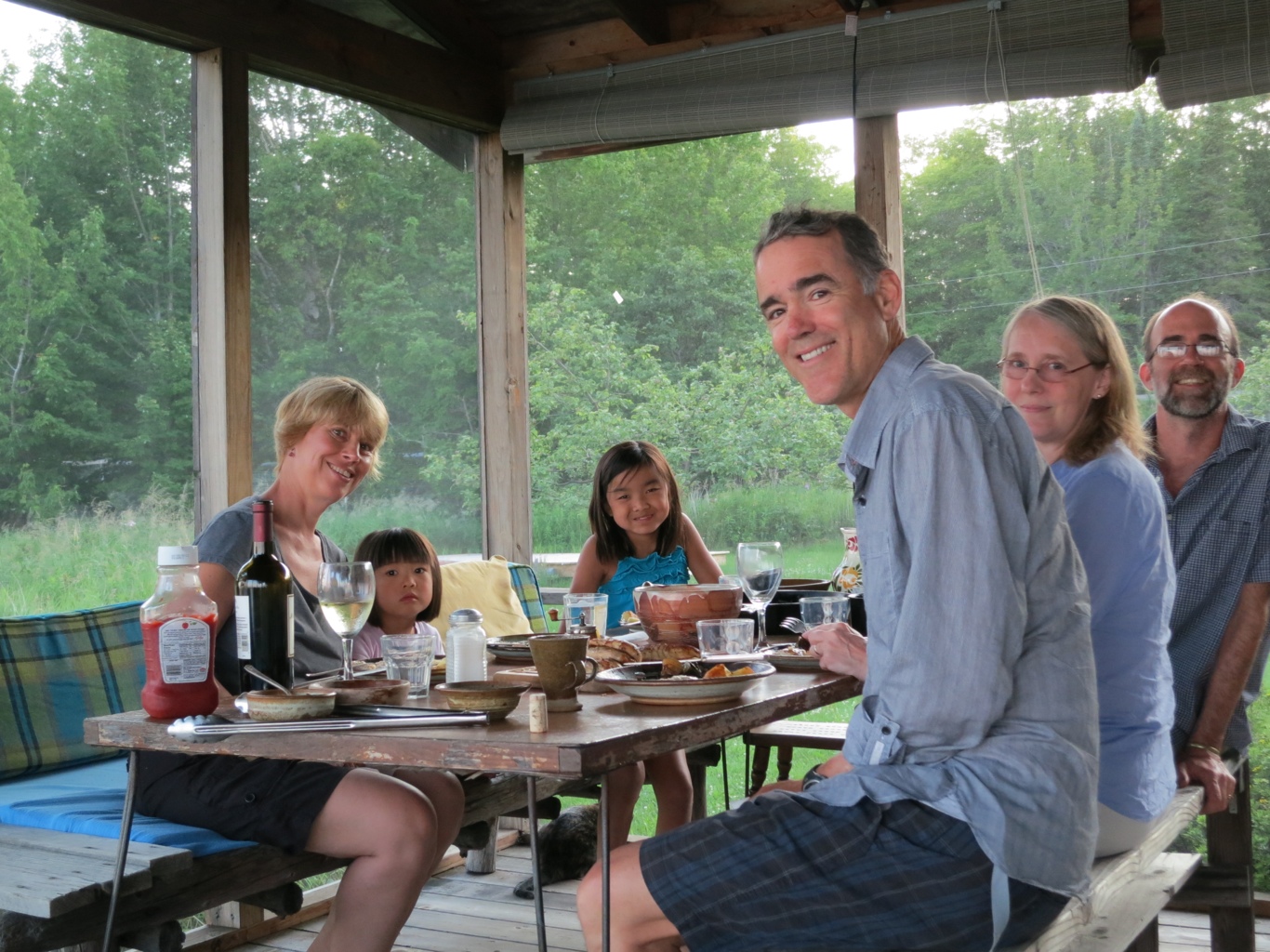
We head up island again to have dinner with Leisa’s childhood friend and family, Ethan, Sherry, Rui-Rui and Eva.

20120714-223349.jpg

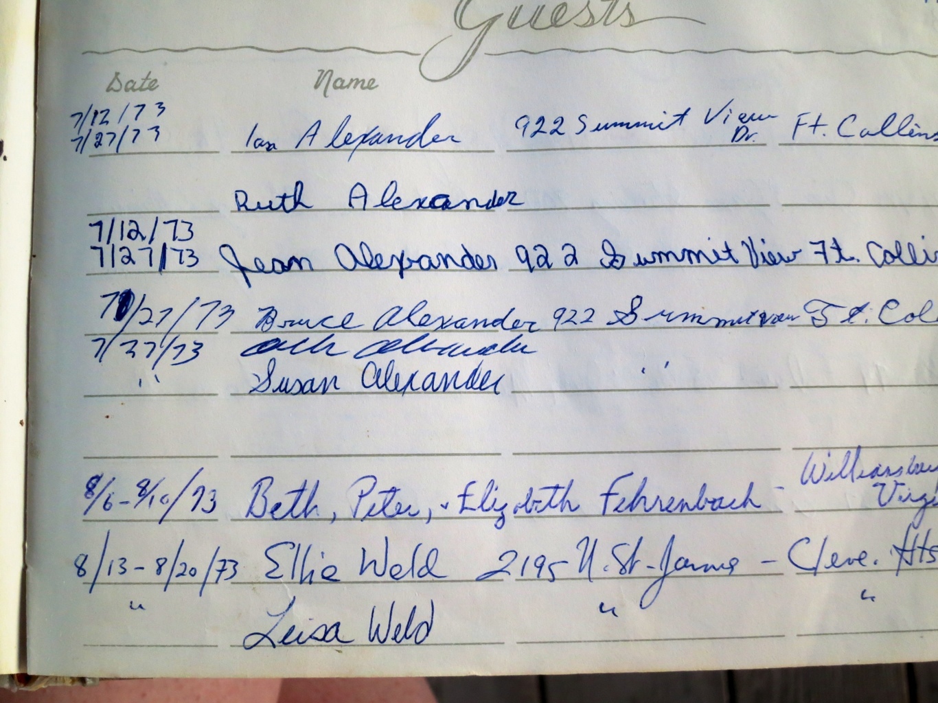
We enjoy dinner together and we find evidence that Leisa (and her mother) was here in 1973 in the guest book. An eight day stay in fact, and maybe the time Leisa, that rebel, put the extra “e” in her name. Something hatched on this very spot nearly, ummm, forty years ago.

20120714-223931.jpg

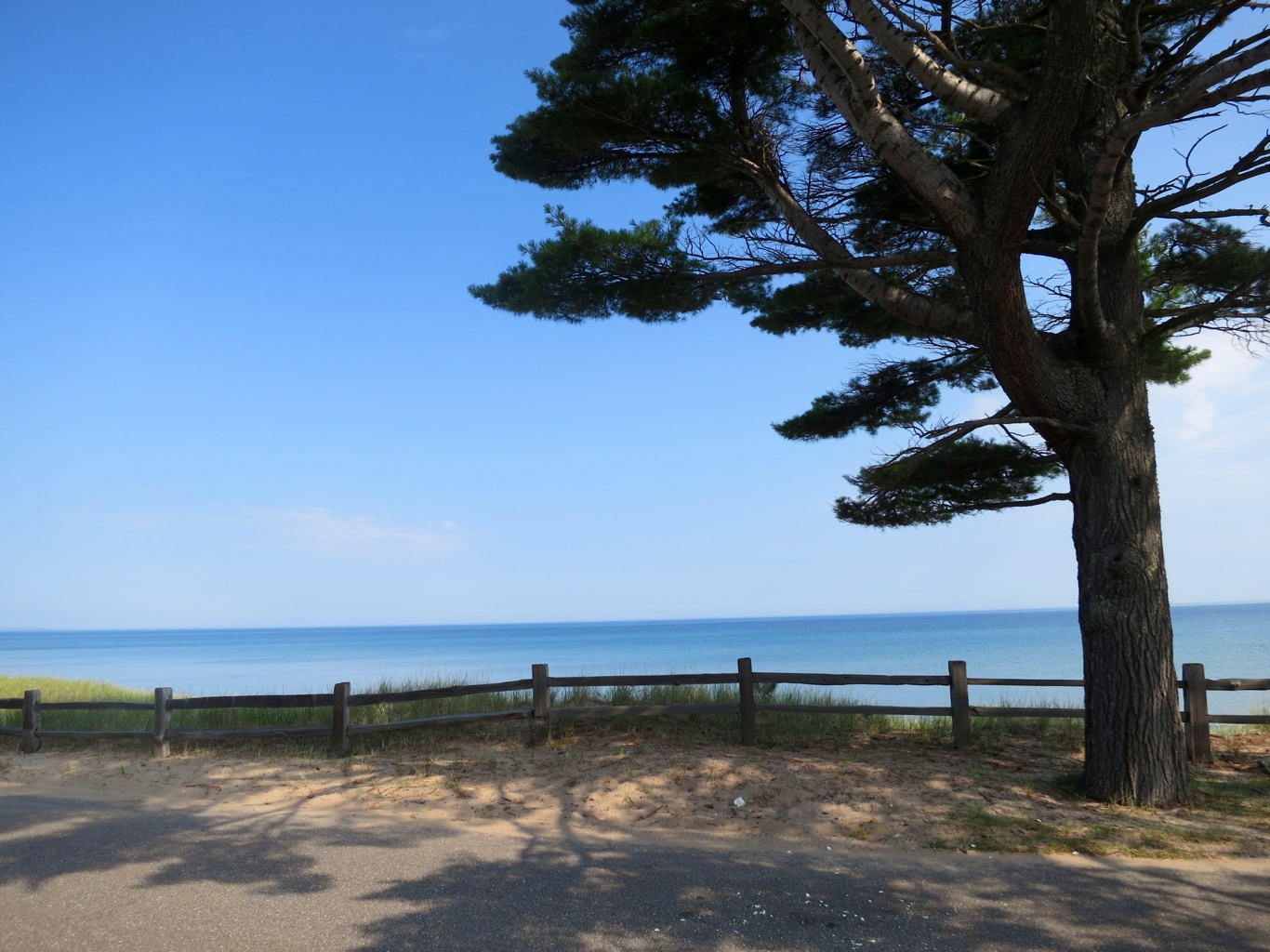
And the sun sets on my rest day and the float we played on when the sun was high in the sky.

20120714-224210.jpg

Stats – for Tuesday 10 July 2012

No cycling today – rest day. Yeah the second one since this journey began.

Unexpected Island Visit

I make my way out of Cloquet through a circuitous route avoiding the many roads and bridges damaged and even washed away in Duluth’s ten inch rain deluge from two weeks earlier. It even flooded the zoo allowing a polar bear and several seals to swim to freedom. But all were subsequently recaptured. This is one part of the US where people talk openly and comfortably about climate change. It’s happening.

It was a beautiful day for a bike ride, made even more so because I was on small county roads weaving my way back to Route 2. I found an old bridge over the St. Louis River underneath an even older train bridge. All the signs suggested even a loaded touring bicycle might be too much. But I am not loaded.

20120712-221348.jpg

Not sure if you can get a sense from the photo but all the rivers are well swollen beyond their normal banks.

20120712-221622.jpg

Cool temperatures, low humidity, big puffy white cumulus clouds overhead providing moments of shade now and then. It was a bit sad when I finally made it to the highway after fifty km of cycling bliss. It was back to Route 2 with its two, three and sometimes four lanes overly exposed to the sun and wind. At a lunch stop, I meet a dozen women who are celebrating eight years of friendship with a cake. Turns out all of them are widowers who get together regularly. They sweeten the rest of my ride with a big slice of cake.

20120712-220855.jpg

I pedaled through what seemed like endless road construction, some with very little space for a cyclist. And all the new pavement did not have markings for a shoulder so I felt quite exposed. When I finally came upon the a long single lane section bordered by hot poured asphalt, luckily Leisa was nearby. I abandoned this section and took a tow to Route 13, which leads north up a peninsula to the Apostle Islands National Seashore and Madeline Island, where Leisa and I decide to take a rest day before she heads back to British Columbia. Turns out this is where she spent a few summer vacations as a teenager. I make it to the ferry just as it is about to lift its loading ramp. Leisa here is either contemplating how to deal with someone who is chronically late or her childhood.

20120712-222203.jpg

We get to Madeline Island as the sun is setting and find a little Inn and a place to eat on the water. What ocean like beauty Lake Superior is able to mimic.

20120712-222608.jpg

Stats – for Monday 9 July 2012

Start: Cloquet
Finish: Madeline Island
Distance: 93 km (cycling)
Time on Bike: 4 hrs 26 min
Average Speed: 20.7 km/hr
Distance to Date: 4,316 km

East of the Mississippi

A warm sunny day ride from Grand Rapids to Cloquet Minnesota with a bit of a tailwind all day. Grand Rapids is home to the source of the Mississippi river and it was kind of sad to see that just as the river gets started there is a huge paper mill, very likely beginning the pollution and sediments that are dumped into this river. This is the first time I have seen piles of logs since British Columbia.

20120710-234432.jpg

And right next to them a huge paper mill.

20120710-234900.jpg

In any case, another psychological milestone to now be east of the Mississippi river.

I make my way to Cloquet to keep just south of Duluth having heard that Route 2 and the big Interstate highways join on the bridge heading into Duluth. Took Route 33 south to Cloquet and encountered a bathtub sized sinkhole on the shoulder but saw it in time to save myself from what certainly would have been a head over heels fall. I needed this reminder to stay totally alert even when I have good sized shoulders to ride on.

I enjoy the sag wagon and Leisa for a drive into Duluth for dinner. Found the area around the canal surprisingly alive and hip. Duluth is making a real come back with lots to do outdoors. It has used its Industrial history like an artistic backdrop for its revitalization.

20120711-000708.jpg

20120711-000745.jpg

Stats -for Sunday 8 July 2012

Start: Grand Rapids
Finish: Cloquet, Minnesota
Distance: 115 km
Time on Bike: 4 hrs 40 min
Average Speed: 24.6 km/hr
Distance to Date: 4,223 km

Paul Bunyan

20120709-141442.jpg

For climate change deniers who go back ten thousand years or so, here is the explanation for all the lakes of Minnesota. It was not a melting glacier that created all the lakes, it was Paul Bunyan’s footsteps through this part of North America. And the Great Lakes? He created them too so that his blue ox could have a few watering holes.

After leaving Fosston, indeed the open prairies ended and the forested landscape dotted with lakes began.

20120709-145758.jpg

The storms that I experienced several days ago had also ripped through this area, damaging many trees along its path.

20120709-150006.jpg

I make it from Fosston to Bemidji, Minnesota in time for long lunch at a funky coffee shop. We decide to make it a short day and stay in this town that lays claim to being the home of Paul Bunyan. We try for over an hour to find a place, even a place to camp. There is a big little league baseball tournament in town and it is the weekend following July 4th so nothing is available in this lakeside town.

So we drive through the national forest that separates Bemidji from Grand Falls and find an Inn for the evening.

Stats – for Saturday 7 July 2012

Start: Fosston
Finish: Grand Falls (drive from Bemidji to Grand Falls)
Distance: 71 km (cycling)
Time on Bike: 3 hrs 3 min
Average Speed: 23.2 km/hr
Distance to Date: 4,108 km

Goodbye Prairies

I’m digging deep here but after two weeks traversing the prairies – Saskatchewan, Manitoba, North Dakota, Minnesota – there’s just not a lot more to say. Big sky, tough winds, fields of canola, barley and wheat, glacier carved landscapes full of marshland, ponds and lakes, once thriving towns now sleepy and largely abandoned.

So today was another hot day through this landscape crossing into the Minnesota side of Grand Forks.

20120707-222653.jpg

Route 2 continues to be a good choice as a way to tuck under Lake Superior on my way to Ottawa. Wide shoulders with a nice rumble strip but in a year or two, unless the cracks are fixed, they will become a field of weeds.

20120707-223505.jpg

I love how the grasses that grow along the side of the road and in the median strip are harvested, fed to cattle and, I guess, end up on our dinner plates.

20120707-224040.jpg

As today will be the last one in the prairies, I take a look back as the sun sets to see that big sky once again.

20120707-224256.jpg

Stats – for Friday 6 July 2012

Start: Grand Forks, North Dakota
Finish: Fosston, Minnesota
Distance: 113 km
Time on Bike: 5 hrs 41 min
Average Speed: 19.8 km/hr
Distance to Date: 4,037 km